🌩️ Severe Weather Threat Expands Into Monmouth & Middlesex Counties
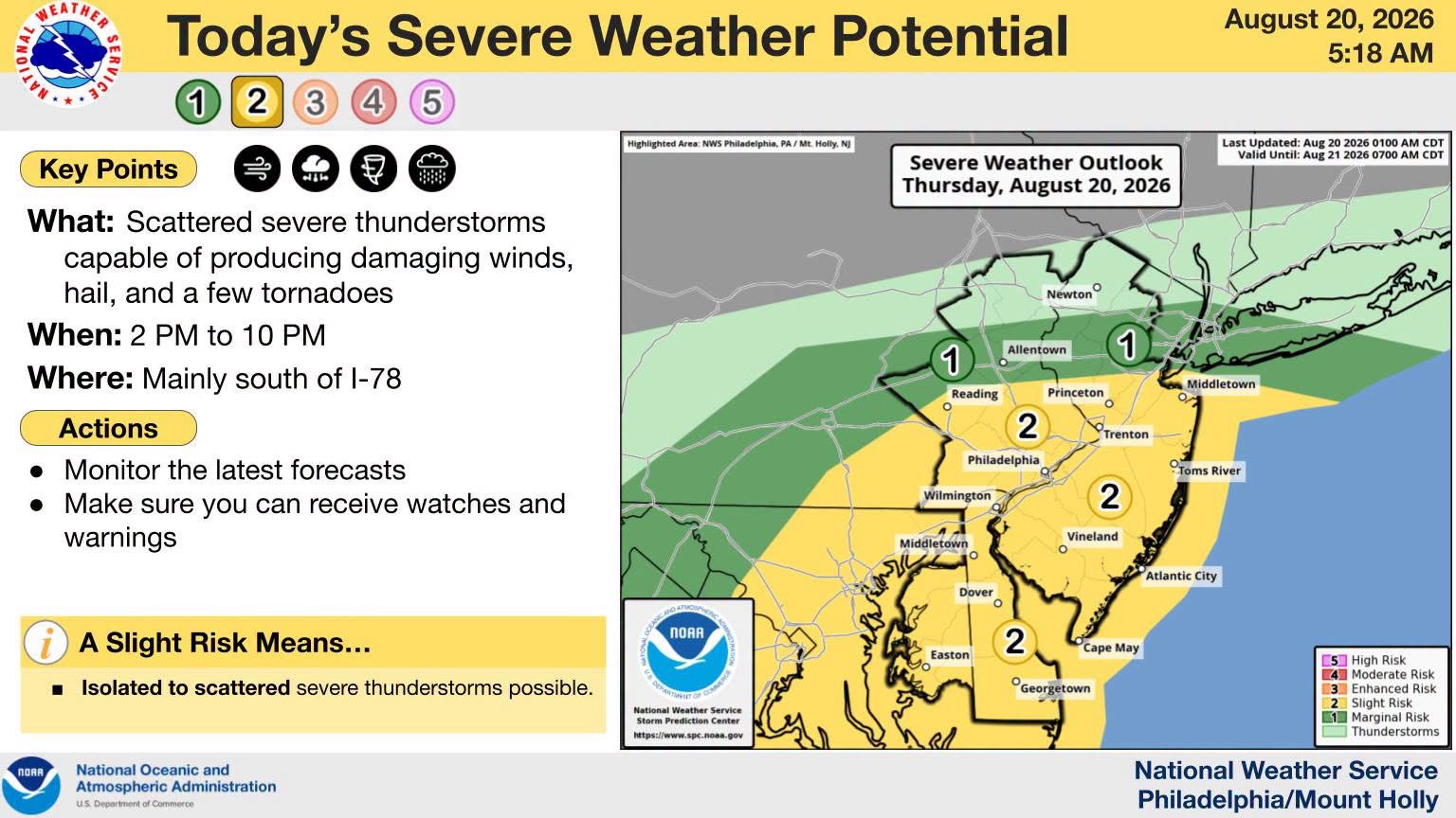
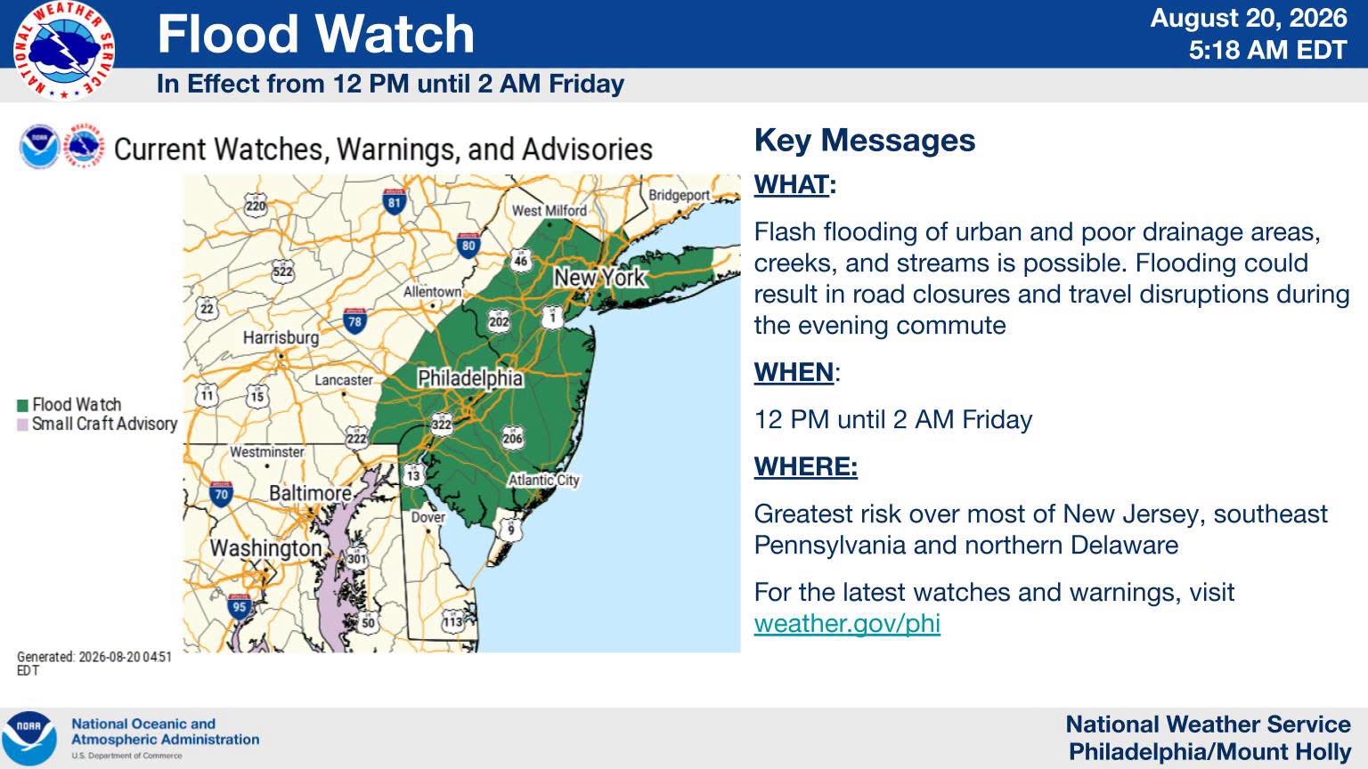
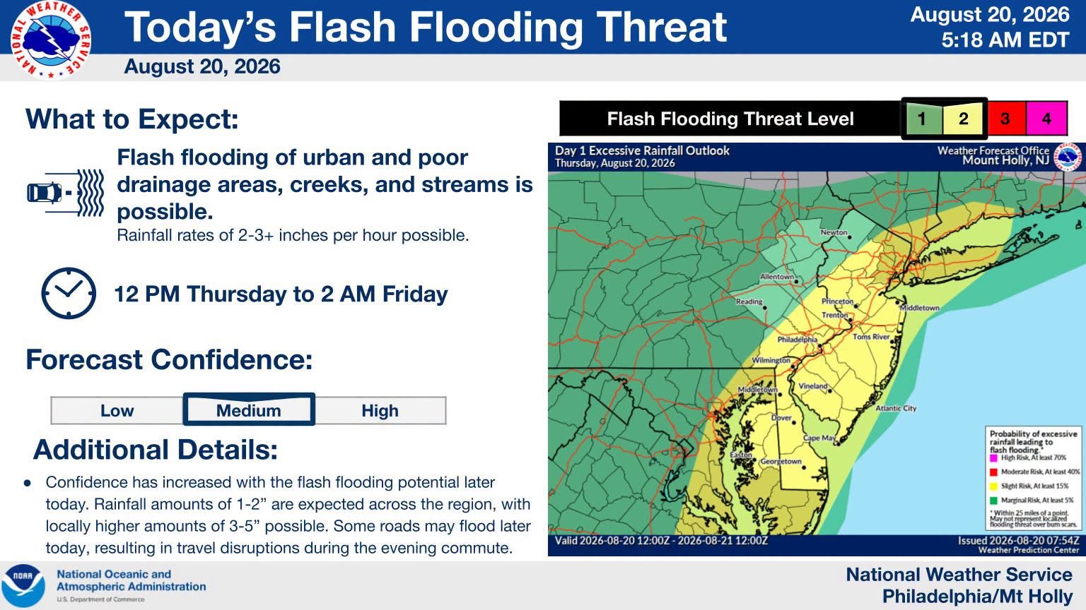
Severe weather threats have expanded to include Monmouth and Middlesex counties, with storms expected from early afternoon through this evening. Residents should prepare for potential damaging winds, hail, tornadoes, and flash flooding that could significantly disrupt the evening commute.
Garden State News Network | Weather Alert
⚠️ The severe weather threat has expanded farther north, now including parts of Monmouth and Middlesex Counties, with an active day expected across the region.
⛈️ Storms are expected to begin developing by the early afternoon and continue into the evening hours. Some storms could become strong to severe, bringing the potential for:
💨 Damaging wind gusts 🧊 Hail 🌪️ A few tornadoes 🌧️ Very heavy rainfall
Rainfall rates of 2–4 inches per hour are possible in the heaviest downpours, creating the potential for flash flooding, road closures and significant disruptions to the evening commute.
🚨 Residents are urged to stay weather aware throughout the day and have multiple ways to receive emergency weather warnings. Never drive through a flooded roadway.
🗺️ SEVERE WEATHER OUTLOOK MAPS: Severe Weather Outlook maps provided by the US National Weather Service Philadelphia/Mount Holly are included with this report. The maps highlight areas at risk for severe weather and provide additional information on today’s threat.
📲 Follow Garden State News Network for continuing weather updates, warnings and local conditions.