⚠️🌩️ SEVERE WEATHER & FLASH FLOODING THREAT INCREASES FOR THURSDAY
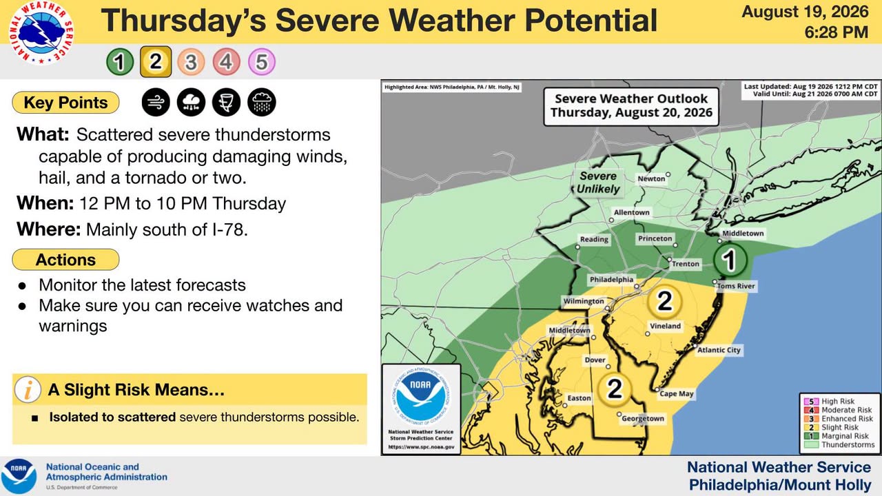
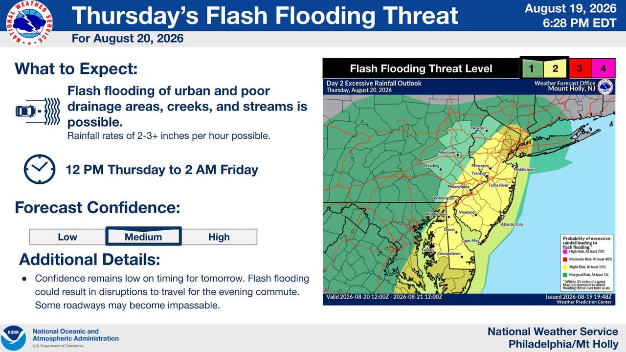
Severe thunderstorms and flash flooding are expected across New Jersey this Thursday, with the highest risk along the Interstate 95 corridor. The National Weather Service warns of damaging winds, isolated tornadoes, and heavy rain throughout the afternoon and evening.
NEW JERSEY — The threat for severe thunderstorms and flash flooding has increased for Thursday, with portions of New Jersey facing potentially dangerous weather conditions. The National Weather Service Philadelphia/Mount Holly office is highlighting the potential for severe storms and flash flooding, with the greatest concerns along and southeast of the I-95 corridor.
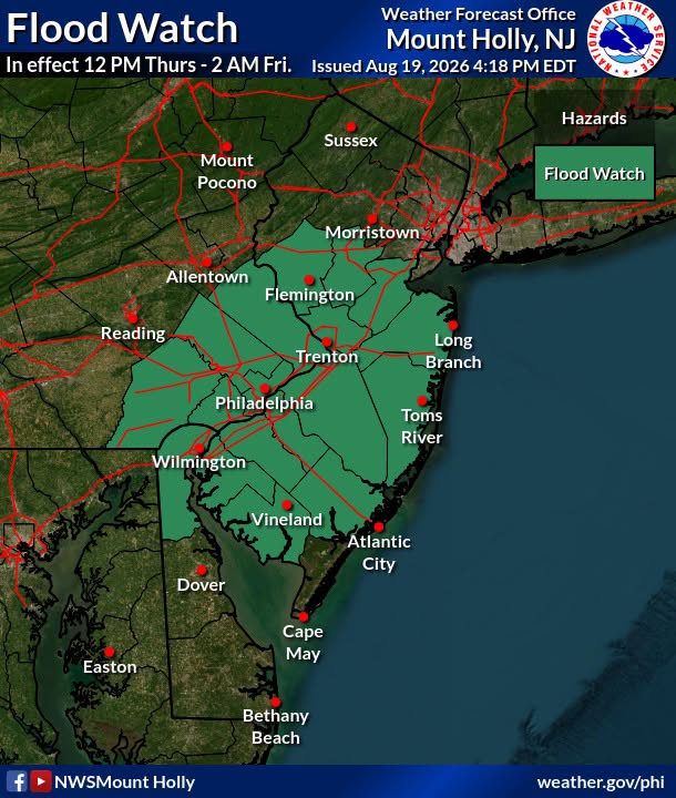
🕛 STORM TIMING: 🌦️ Late Morning–Early Afternoon: Showers and thunderstorms may begin developing. ⛈️ Afternoon–Early Evening: Greatest potential for severe weather, including damaging winds and a few tornadoes. 🌧️ Thursday Afternoon–Overnight: Flash flooding will remain a concern, particularly within the Flood Watch area. The current Flood Watch extends from 12 PM Thursday through 2 AM Friday for portions of New Jersey and surrounding areas.
🌪️ POTENTIAL THREATS: 💨 Damaging wind gusts 🌪️ Isolated tornadoes 🌧️ Torrential rainfall 🌊 Flash flooding ⚡ Frequent lightning
🗺️ SEVERE WEATHER OUTLOOK MAPS: The Severe Weather Outlook Maps provided by the U.S. National Weather Service Philadelphia/Mount Holly are included with this post. These maps help show the areas currently at risk for severe thunderstorms and flooding.
🚨 STAY WEATHER AWARE! Have multiple ways to receive weather alerts and be prepared to act quickly if a Severe Thunderstorm Warning, Tornado Warning or Flash Flood Warning is issued.
📲 Garden State News Network will continue monitoring the forecast and providing updates throughout Thursday.
Stay safe, New Jersey! 🇺🇸