🌧️⚠️ SEVERE WEATHER & FLASH FLOOD THREAT INCREASES TODAY ⚠️🌧️
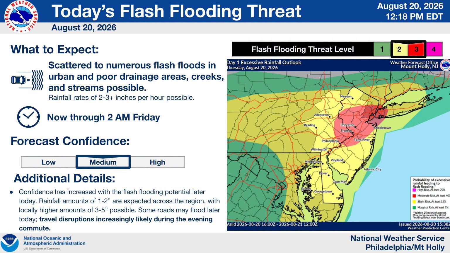
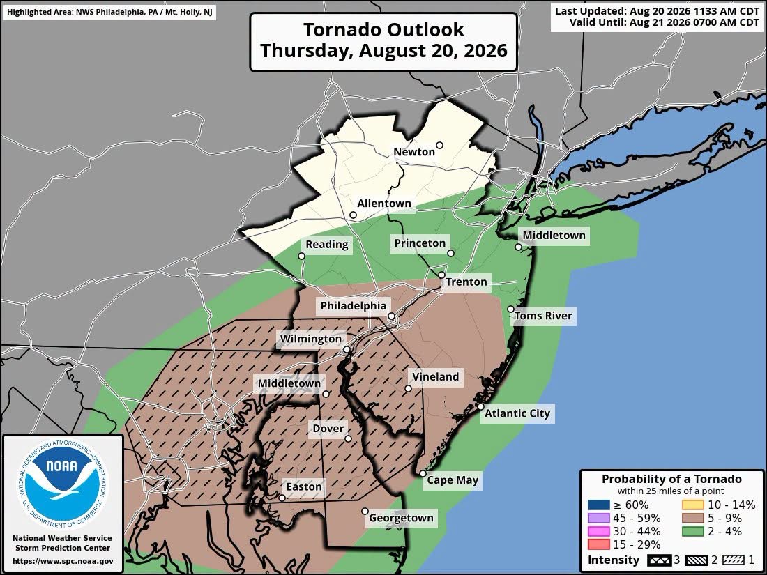
Central and Northern New Jersey face an increased risk of significant flash flooding and severe weather today. The National Weather Service warns that slow-moving thunderstorms could cause widespread travel disruptions, power outages, and potential tornadoes during the evening commute.
The threat for flash flooding and severe weather continues to increase across parts of the region, with portions of the area upgraded to a MODERATE Risk of Excessive Rainfall by the Weather Prediction Center.
📍 The Moderate Risk area includes Philadelphia and extends northeastward into portions of Central and Northern New Jersey, including the Trenton area.
🌊 Flash flooding could become fairly widespread and potentially significant within the Moderate Risk area, particularly where repeated or slow-moving thunderstorms develop.
🌪️ The severe weather threat also remains in play, including the potential for a few tornadoes, along with damaging winds from stronger storms.
🚗 Travel disruptions are increasingly likely for the evening commute. Some roads could flood later today, while severe thunderstorms may produce downed trees and power lines.
🗺️ SEVERE WEATHER OUTLOOK MAPS: The Severe Weather Outlook Maps provided by the National Weather Service Philadelphia/Mount Holly are included with this update. These maps highlight areas facing the greatest potential for severe weather today.
⚠️ Never drive through a flooded roadway. Turn around — don’t drown.
Garden State News Network will continue monitoring conditions and provide additional updates as they become available.