⛈️ Severe Thunderstorm Threat Increasing Across New Jersey
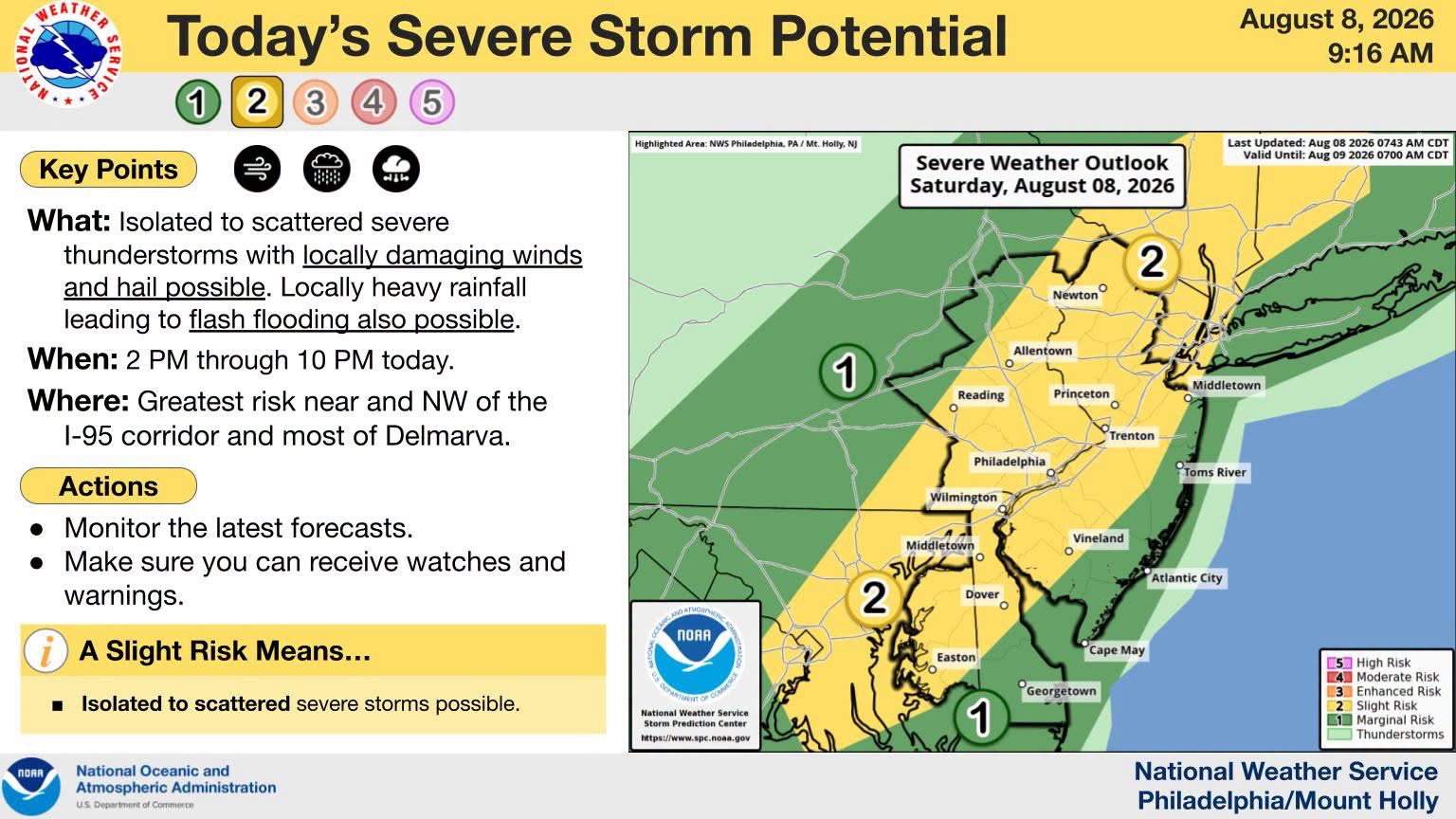
Severe thunderstorms are expected to hit New Jersey this afternoon and evening, bringing risks of damaging winds and flash flooding. Residents should prepare for potential power outages and downed trees, especially along and northwest of the Interstate 95 corridor.
The threat for severe thunderstorms is increasing this afternoon and evening, with the greatest potential for stronger storms generally near and northwest of the I-95 corridor, extending into much of the Delmarva region.
🌬️ The primary concern is locally damaging wind gusts, which could result in downed trees, power lines and scattered power outages.
🌧️ Locally heavy rainfall is also possible, creating a risk for flash flooding, particularly in areas that experience repeated or slow-moving thunderstorms.
Residents across New Jersey should remain weather-aware this afternoon and evening, monitor the latest forecasts and warnings, and be prepared to seek shelter if severe weather develops. Recent forecasts also indicate an increased severe-weather threat along the I-95 corridor, with damaging winds and flash flooding among the primary concerns.
🚨 GSNN WEATHER ALERT: Conditions can change quickly. Have multiple ways to receive weather warnings and never drive through flooded roadways.