⛈️ SEVERE THUNDERSTORM & FLASH FLOOD THREAT CONTINUES THURSDAY
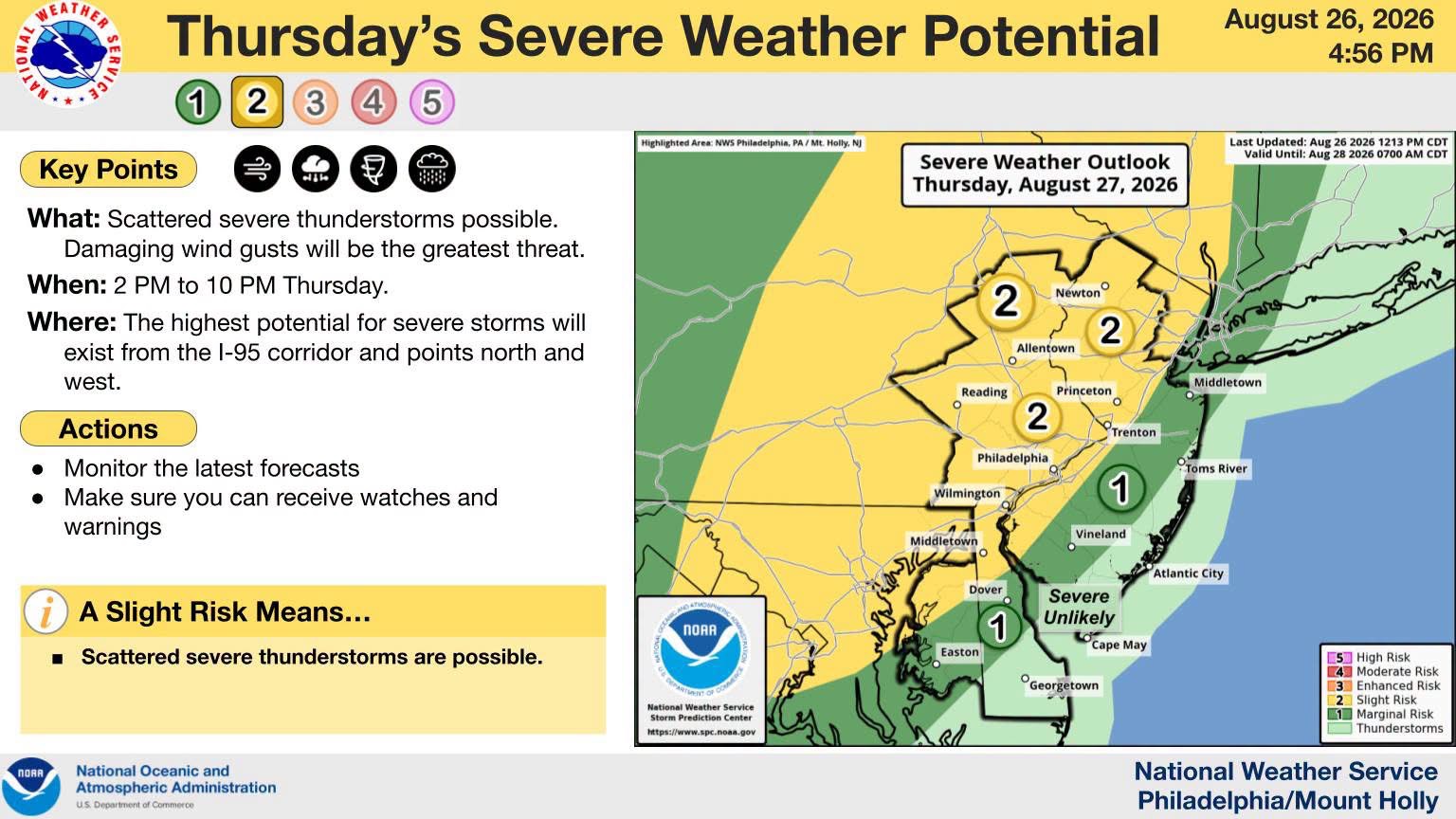
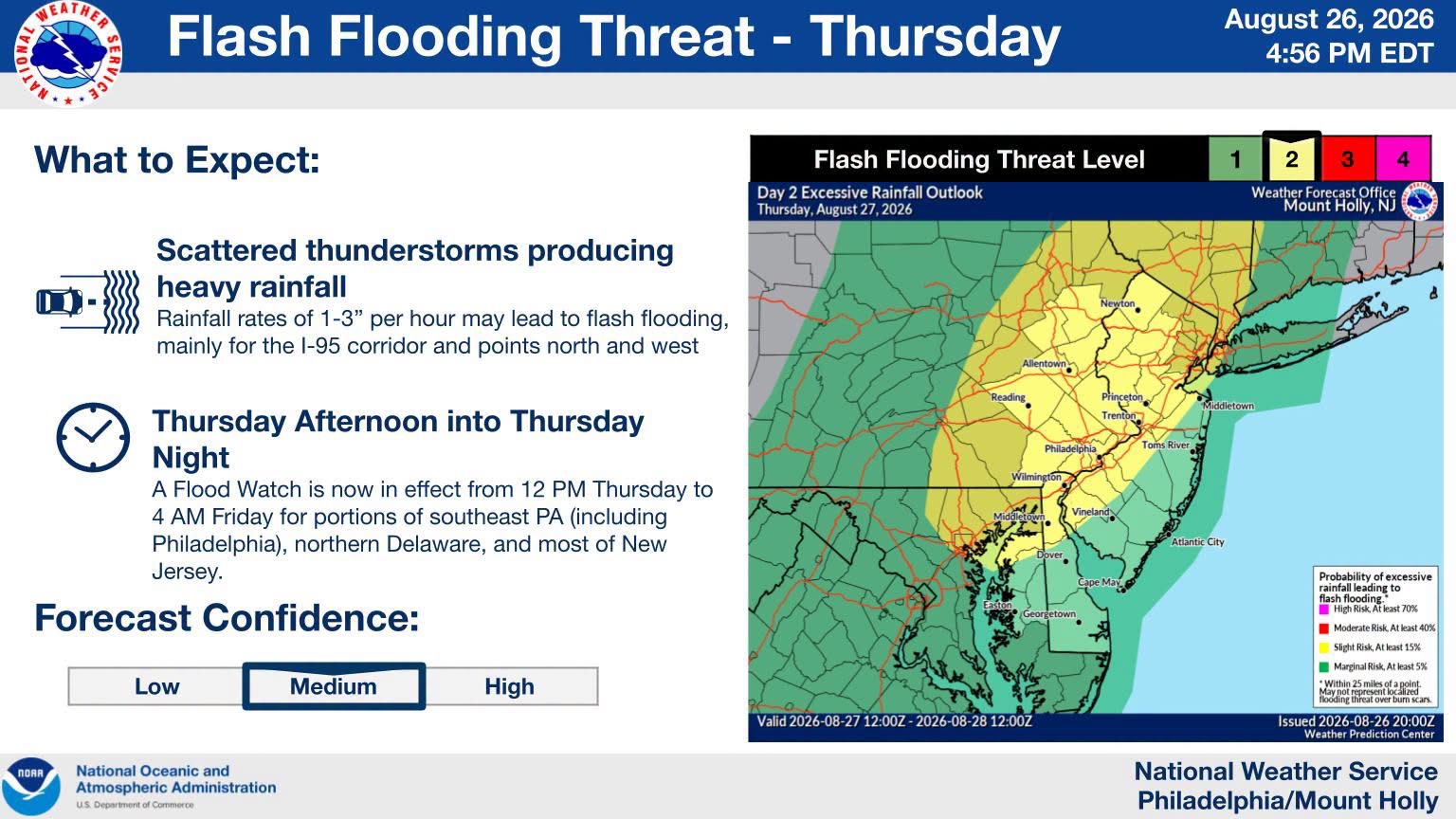
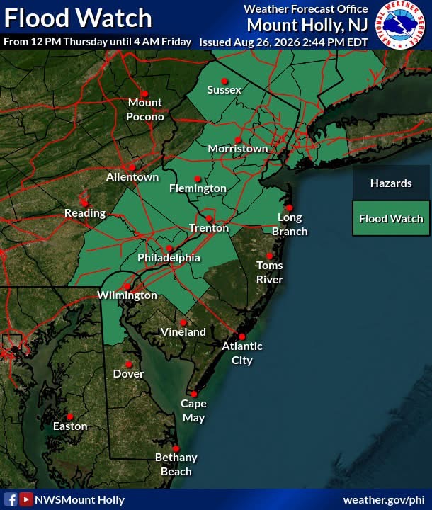
New Jersey residents should prepare for severe thunderstorms and potential flash flooding on Thursday afternoon. The National Weather Service warns that areas along Interstate 95 face the highest risks for damaging winds, heavy rain, and an isolated tornado.
NEW JERSEY — August 27, 2026 — A threat for isolated to scattered severe thunderstorms and flash flooding continues across parts of New Jersey Thursday afternoon and evening.
The National Weather Service Philadelphia/Mount Holly office says the greatest concern is generally along and northwest of the I-95 corridor, where some stronger storms could produce damaging winds and torrential rainfall. A brief tornado cannot be ruled out, although the tornado threat remains lower than last Thursday. (Facebook)
🌧️ Flash flooding is also a concern, particularly in urban areas and locations with poor drainage. The National Weather Service notes that locally heavy rainfall rates could lead to rapid flooding. (National Weather Service)
⚠️ Not everyone will experience severe weather, but residents should remain weather-aware throughout the day and evening.
🏠 If a severe storm approaches, move indoors and stay away from windows.
🚗🌊 NEVER DRIVE THROUGH FLOODED ROADS! TURN AROUND, DON’T DROWN.
🗺️ WEATHER MAPS: Maps accompanying this report are provided by the US National Weather Service Philadelphia/Mount Holly and show the latest severe weather and flash flood threat areas.
📲 Garden State News Network will continue monitoring the weather and provide updates as conditions change.