🌩️ ISOLATED SEVERE THUNDERSTORMS POSSIBLE ACROSS NEW JERSEY TODAY
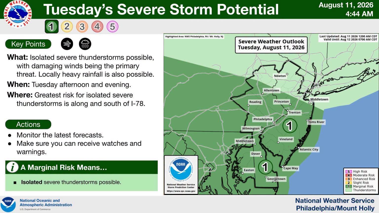
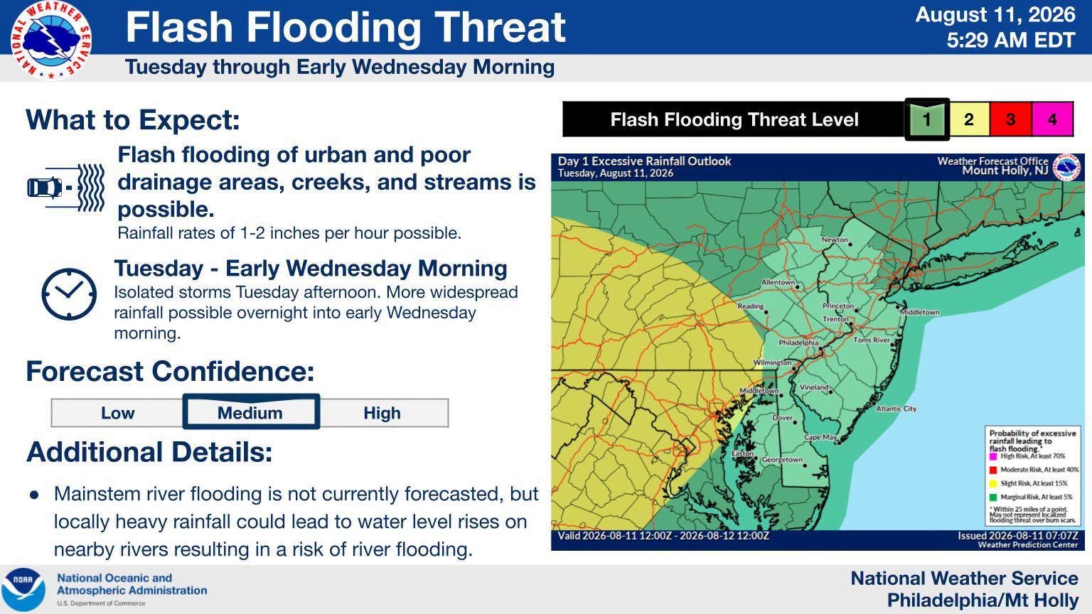
Isolated severe thunderstorms are possible across New Jersey this afternoon and evening, bringing threats of damaging winds and heavy rain. Forecasters warn that flash flooding is also a concern through Wednesday morning, and residents should avoid driving through flooded roadways.
NEW JERSEY — Residents should keep an eye on the sky today as isolated severe thunderstorms are possible across parts of the state, with the greatest potential occurring during the afternoon and evening hours. ⛈️
The primary severe weather threat will be damaging wind gusts, although storms could also produce locally heavy rainfall.
🌧️ Flash flooding is also possible, particularly where slow-moving or repeatedly developing thunderstorms produce heavy downpours. The threat for heavy rain may continue from the afternoon into the overnight hours and early Wednesday morning.
Residents are encouraged to monitor changing weather conditions, especially if traveling or spending time outdoors. Never drive through flooded roadways and remember: Turn Around, Don’t Drown. 🚗🌊
🗺️ Weather maps courtesy of the National Weather Service Philadelphia/Mount Holly.
📲 Stay with Garden State News Network for weather updates, warnings and breaking information throughout the day.